April 11, 2023

Sampling is one of the fundamental processes for characterising a mineral deposit and is carried out at various stages in the evaluation and exploration of a mine. However, in order for important decisions to be made quickly, sample results need to be made available efficiently, especially in remote developments where transport can be an obstacle.
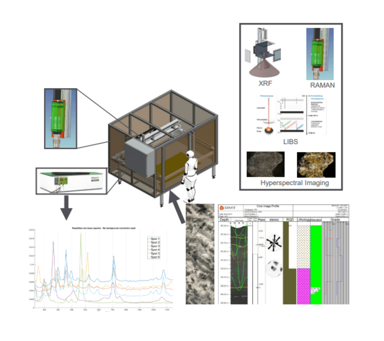
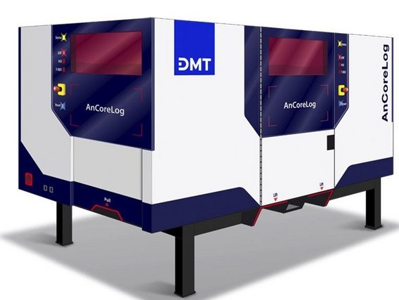
In order to minimise these problems, the DMT Group together with other partners, developed Ancorelog an analytical core drilling scanner system where results can be obtained in real time using a state-of-the-art artificial intelligence system. The algorithms transform the measured properties ("big data") into geological, geotechnical and geometallurgical properties ("smart data"), on site and in real time.
Because of its modular design, Ancorelog can be equipped with different combinations of sensors. The available sensors measure: the chemical and mineralogical composition of rocks, as well as lithologies and alteration zones.
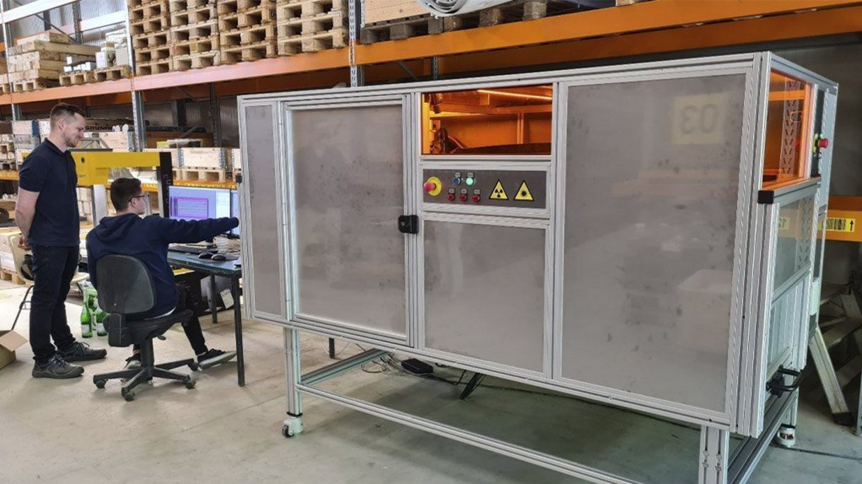
Due to its compact design, Ancorelog can be used both in the field and in laboratories. In addition, the device has passed the health and safety requirements that European regulatory agencies impose on such devices before they can be used in the field.
Machine learning algorithms make precise measurements of the concentrations of chemical elements on the surface of the sample, weighting and interpolating to its total volume.
The physical, chemical and mineralogical properties of the samples are measured at a scan rate of between 20 seconds and 2 minutes per metre of sample. The rate varies depending on the sensitivity and combination of sensors used.
Ancorelog is designed to process samples with a maximum length of 125 cm, a width of 50 cm and a diameter of 15 cm. A laser sensor first scans the surface of the samples and determines an optimal measurement path for each of the sensors. The sensor measurements are carried out individually and sequentially in an automated process, and can reach a scan rate of 20 to 60 metres per hour, depending on the combination of sensors and the accuracy of the measurements.

Data from different sensors is compiled, merged and stored in the CoreBase (database and analysissoftware), which offers online accessibility and a collection of sample data on a digital record page.
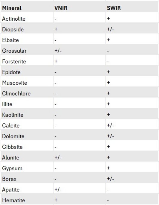
Imaging spectroscopy is a technique that identifies minerals through their absorption and reflection characteristics at specific wavelengths in the electromagnetic spectrum. The near-infrared (VNIR) region (0.4 to ~ 1 um) allows for the discrimination of Fe-oxides and oxyhydroxides in base metal deposits, while the short-wave infrared (SWIR) region (~ 1 to 2.5 um) contains diagnostic features associated with the absorption of vibrational energy in the crystal lattice, allowing for the discrimination and mapping of distinct minerals or sets of minerals commonly associated with hydrothermal alteration zones around gold and base metal deposits.
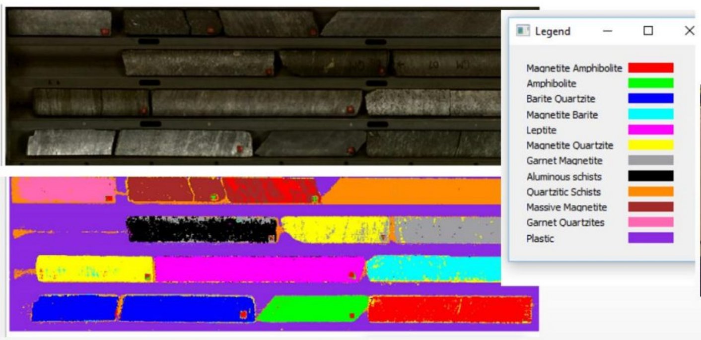
Ancorelog features a high-resolution RGB scanning camera (60 pixels/mm or 1270 dpi). As well as hyperspectral imaging cameras with wavelengths from 400 to 25000 nm. The RGB line scan camera and the hyperspectral cameras scan all the samples sequentially, allowing for high spatial resolution, so that the images are generated automatically to match the analysis.
The table below shows in which region of the infrared spectrum (VNIR/SWIR) different minerals are detected:

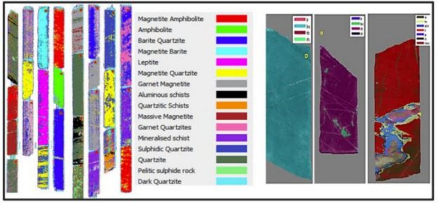
The use of hyperspectral images in Ancorelog is not limited to detecting and mapping minerals. Neural networks are trained to identify different classes of interest, for example: lithologies and alteration zones. The neural network can also be adapted to identify certain mineralogical compositions, representative of lithologies or alteration zones.
The X-ray fluorescence sensor can be equipped modularly with a Timegated Raman sensor for mineral identification, as well as plasma spectroscopy technology for measuring chemical composition as a complement to the X-ray fluorescence sensor.
The XRF sensor scans continuously along the centre axis of the borehole core, integrating the measurement results over a variable period. In addition, the measurement ranges can vary from 1 to 100 cm, unlike portable XRF devices.
Similar to the FRX sensor, the LIBS sensor can measure continuous profiles in the borehole core and add detailed maps of the distribution of elements on the surface of the sample.

By combining the images with the XRF measurements, a classification model based on machine learning algorithms can be trained automatically by geologists to identify lithologies, alteration zones and the chemical or mineralogical composition.
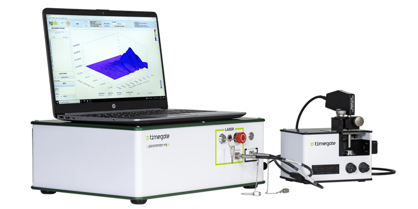
T-REX is a time-controlled Raman sensor that can be integrated into the Ancorelog logging system.

Time-gated Raman technology brings a significant improvement to RAMAN technology, enabling fast and accurate mineralogical analysis of samples, as well as being applicable to a wide range of minerals, including critical minerals such as lithium. The mineralogical composition data collected via the T-REX sensor is combined with data from Ancorelog's various sensors and enhanced intelligent algorithms designed to classify samples into geological and geometallurgical domains.
Due to Ancorelog's automatic scanning process together with an automatic roller conveyor, the instrument can handle the daily sampling of ongoing projects and also analyse large volumes of drill cuttings.

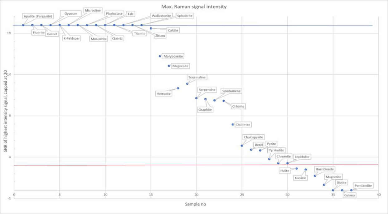
The minerals detectable by Ancorelog include: apatite, fluorite, garnet, gypsum, k-feldspar, microcline, muscovite, quartz, plagioclase, talc, tantalite, wollastonite, zircon, sphalerite, calcite, molybdenite, magnesite, tourmaline, hematite, serpentine, graphite, spodumene, chlorite, dolomite, chalcopyrite, beryl, pyrite, pyrrhotite, chromite, lepidolite, halite, kaolinite, hornblende, magnetite, biotite, pentlandite and galena.

Ancorelog is partly funded by the EIT RawMaterials.
With accurate and consistent results in near real time, Ancorelog contributes to rapid decision-making in exploration and deposit evaluation. The qualitative data also allows for a significant improvement in geological deposit models and can therefore significantly enhance the planning and exploration of a mineral venture.
You can check out other products and more information on the DMT website. We've commented on another DMT product on our blog, the CoreScan. You can check it out on our blog, just click here.